Projected Model Data Suggesting High Wind Risks
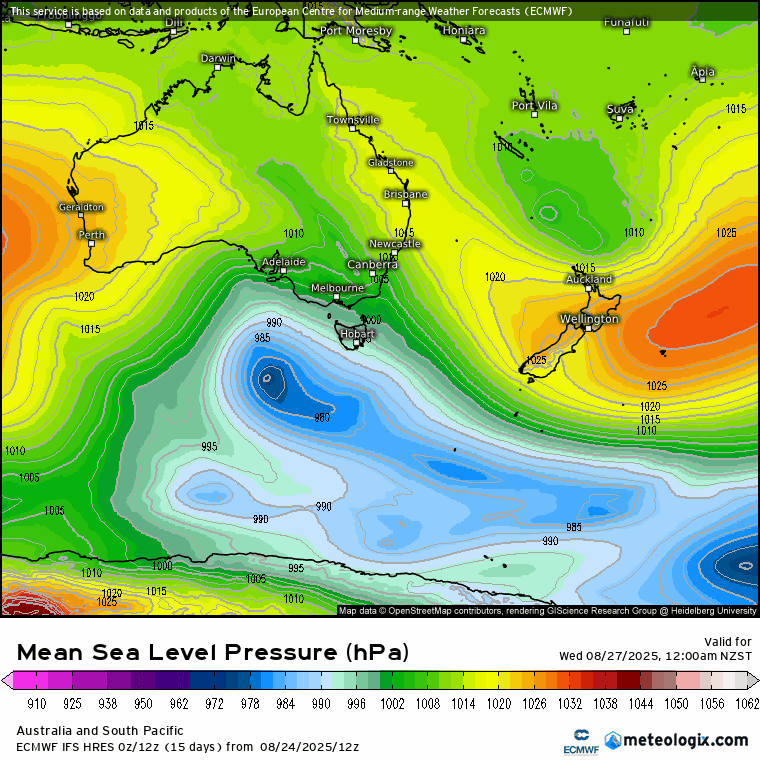
A low pressure system is expected to cross just below Tasmania on Wednesday, gradually pushing up against an area of high pressure located to the northeast of New Zealand. This particular low pressure system has the potential to grow considerably in size, potentially spanning the entire length of the Tasman Sea or even expanding beyond that. According to current model data, the low is forecasted to track below the South Island throughout Thursday and Friday. There is also a possibility of snow developing over the weekend, as the low appears likely to stall in the Southern Ocean before resuming its eastward movement by the end of the weekend.
When examining the Mean Sea Level Pressure map, the area shaded from light blue to purple represents this low pressure system building in strength from Wednesday through to Sunday. The darker the colours become, the deeper the low pressure system is, indicating a more significant drop in air pressure. A "deep low" refers to a system where the air pressure has decreased substantially, resulting in increased intensity or severity of weather conditions such as rain, snow, and wind.
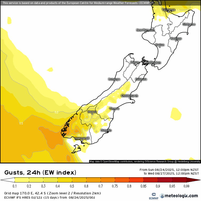
In terms of significant weather impacting the South Island, heavy rain is likely to affect western areas, with Fiordland expected to experience particularly intense downpours. However, the main focus will be on the incoming severe north to northwest winds bringing challenging conditions. On Wednesday, Southland and Otago are set to experience severe wind gusts, especially in regions west of Invercargill and Winton, although much of Central Otago and the Southern Lake District will not be spared from the impact. Wind gusts will begin to increase from late afternoon in the Canterbury High Country, signalling a broadening area of concern.
Thursday is expected to bring the strongest wind gusts as a weather front linked to a low-pressure system moves across the island. Once again, the most severe gusts will target the same areas, though these patterns could shift as more information becomes available in the coming days. On Friday, the winds will ease somewhat but are not expected to completely dissipate, with weekend conditions likely to remain quite windy. Below is an Extreme Weather Index depicting the 24-hour wind gust potential. This index does not indicate the exact speeds of the wind gusts but rather highlights how unusual the forecasted gusts are for this time of year, considering the specific location and surrounding topography.