
Southern and Eastern Regions to Brace for Wintery Conditions
Southland, Otago, Canterbury, and Marlborough are all expected to receive another significant snow dump, which in some areas could potentially be more severe than the event that occurred just over a week ago. This particular weather system has been closely monitored and has remained on our radar continuously since the beginning of this past week (11/08/25 - 16/08/25). As is often the case with snow-related weather events, this one has also shown a high degree of unpredictability. With each update to the weather models, we have observed varying details and variables; however, the overall outlook has remained fairly consistent. In the last few days, the available snow depth projections have become more aligned across different sources, although the precise altitude at which snow will begin to fall continues to fluctuate and remains uncertain at this stage.
Winter weather animated map: Rain in blue, Snow depth in purple and Snow cm/per hour in white.
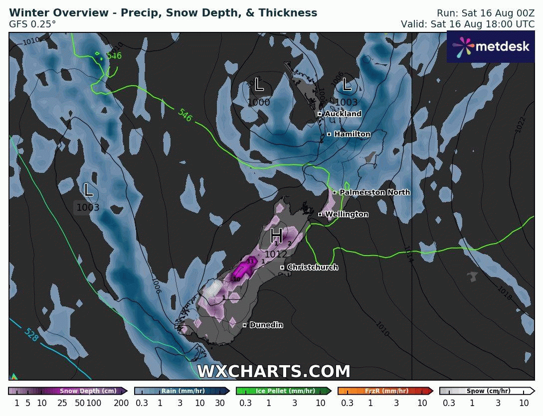
This snow event is forecasted to arrive late Sunday afternoon or evening for Southern Fiordland, with the bulk of the significant weather expected to occur on Monday and Tuesday. In our Significant Weather Outlook, we have outlined that there is a risk of heavy snow falling down to around 600 meters elevation. Snow is also likely to fall to lower levels in some areas, although it is not expected to develop into a significant risk at those altitudes. There is the potential for light snow flurries near the 400-meter mark across Southland, Otago, and Canterbury regions, but this situation is likely to change as the event progresses.
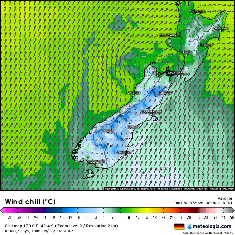
Wind Chill will be a significant factor in this upcoming weather event. As the cold air mass moves in, strong and sustained wind speeds will cause the wind chill, or the ‘feels like’ temperature, to drop noticeably across the entire island. At lower altitudes, actual temperatures may remain above freezing, but wind chill values could fall to around zero degrees, making conditions feel much colder. Meanwhile, in higher altitude regions, wind chill temperatures are expected to drop well below freezing, increasing the risk to livestock.
For more detailed snow forecasts, subscribe to our Snow Cast