
More Significant Rainfall For Upper South Island
A large area of low pressure is forecast to approach the Western South Island on Friday, bringing widespread swaths of rain to the north and west of the South Island and possible severe gales for a number of regions as low pressure passes over New Zealand. SIMA forecast analysis team are also watching heavy rain potential for Buller, Westland and Fiordland.
The upper South Island has already received between 100-200mm for coastal areas and 200mm+ for inland areas of Tasman region in the last heavy rain event in June. This event only weeks apart is due to climate data point us towards positive SAM values for the month of July. Our full July climate outlook can be found here
Northeast winds begin to strengthen throughout Friday as the center low progresses towards the island. There is still some uncertainty with maximum wind gusts at this stage due to complexity of the low. Windspeeeds look to vairy throughout Friday and into Saturday.

The above maps show heavy rain on with the significant intensity lashing the west and north of the South Island. Rain intensity values display heaviest rain in purple with moderate to light descending from dark blue to light blue being light rain. Both maps should be views for information purposes only.

The low is forecasted to bring strong winds with northern and eastern coastal regions likely to be affected the most. Darker pink/red indicates areas of most severe winds of severe winds with orange and yellow showing strong winds that could become severe.
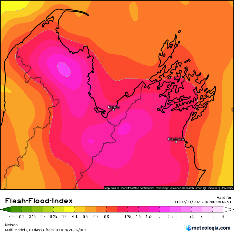
Heavy rain is set to fall from 11am Friday to 3am Saturday. This timeframe which is less than 24 hours will likely cause rivers and streams to rise very quickly creating a significant risk of flash floods. The topography of both Tasman and Nelson regions elevates this possibility as indicated on this map.
The index takes into consideration the topography of the land and calculates the likelihood of a flash flood based off rain accumulation forecasts during that period of time to calculate the potential possibility. Heavy rain risk does not always result in a flash flood so this index map provides another layer to help issue our forecasts in our Significant Weather Outlook
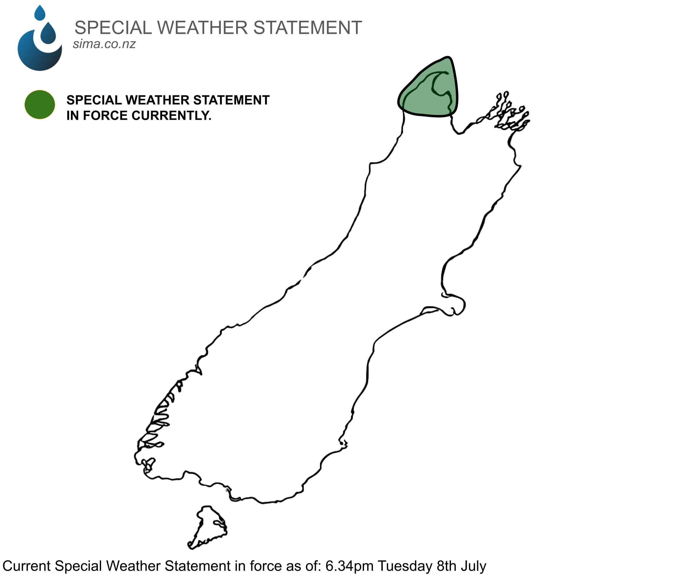
SPECIAL WEATHER STATEMENT
A special weather statement has been issued at 6:34pm Tuesday 8th July with important information regarding what what the affected areas can expect including rainfall totals.
We advise residents in the Tasman region to view this information and to see the forecasts leading up to Friday incase of any changes. All forecasts will be updated each day.
Special Weather Statement can be viewed here
Significant Weather Outlook can be viewed here