Stormy Southern Ocean: What Does It Mean For The South Island?
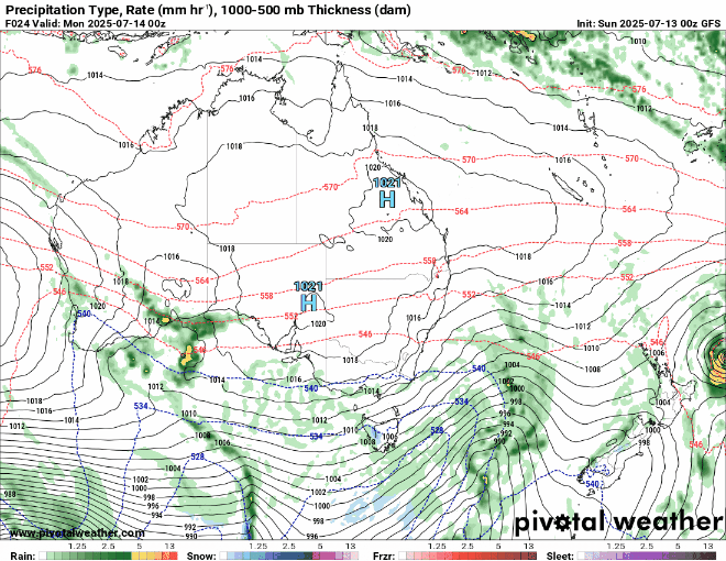
Activity in the Tasman Sea looks to subside this week but incoming fronts from the southwest will continue to bring rain showers to western regions and light snow to higher alpine areas.
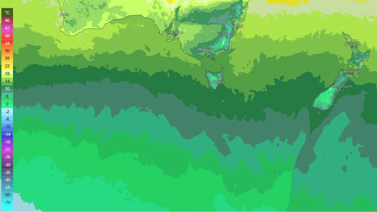
The Southern Ocean below Australia has gained some momentum with low pressure systems moving in a easterly direction towards New Zealand. While we don’t expect a major weather events to occur this week we can expect more winter-like temperatures to return as wind directions change from the mild north/northeast to a more southwest airflow.
Below is a forecast map for the next week starting Monday until Sunday.
Temperatures will feel more like winter as the activity in the Southern Ocean and a southwesterly airflow mix together over the coming week. Overnight frosts for parts of Canterbury, Otago and Southland are on the cards from about midweek onwards as most of the front arriving from the southwest are not likely to make it over the Southern Alps, creating ideal conditions for frost to form for some areas. Some areas may reach negative temperatures but may only get very light or no frosts due to cloud cover.
Below are maximum day time temperatures which do not take into account wind chill which affects the “feels like” temperature.